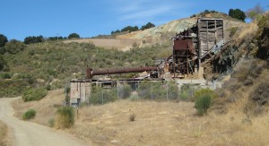
 I hiked the historic Quicksilver Trail in Almaden Quicksilver Park in San Jose in October 2009 . Boy Scout Troop 466 compiled the historical information about this hike as an Eagle project. The trail takes you past the ruins of the first economic boom of San Jose – the New Almaden Quicksilver Mine.
The New Almaden Mine, named by its Spanish founders for the Almaden mine in Spain, pumped out millions of tons of quicksilver (mercury) in the 1800’s, a critical component of gold production during the gold rush. During its heyday, the town of New Almaden at the base of the mountains housed 1800 residents. It was a bustling manufacturing town, much more so than the farming center of San Jose twelve miles to the north.
The historic trail is described in a brochure generally available at the Hacienda trailhead. The park trail map is also generally available at the trailhead. Unfortunately, the historic trail brochure does not give mileage (and a few directions are unclear) so you definitely want both in hand.
The trail starts at the Hacienda trailhead and proceeds to go continually upward for about 1000 feet over about one and a half miles. Luckily, this area is very prettily shaded and not terribly steep.
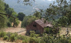 The climb tops out between the peaks of Church Hill and Mine Hill, at the site of the former English camp. This was the high-end area of the hillside encampments where the English-speaking management resided. On Church Hill stood the eponymous church, currently in partial repair. There are remains of the general store and school house, and outbuildings like this partially repaired barn.
Beyond English camp is Spanish camp. Here, the workers were forced to live on a steep hillside. There are no remains of their flimsy shelters. There is a large cemetery area marked only by trees that were planted to commemorate the graves.
The trail circles the peak of Mine Hill, where the first of the shafts (vertical) and tunnels (horizontal) had been built, so much of the industrial equipment needed to process the 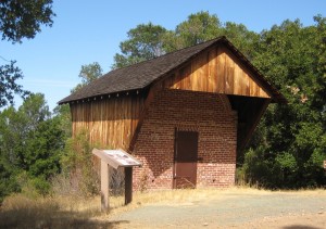 mercury is located here. The rotary furnace pictured above heated the quicksilver to a gas to separate out impurities. The powder house pictured here housed explosives within double walls insulated with manure to keep the dynamite and nitroglycerin cool and stable – and channel the blast if those measures failed. (The powder house was completely restored after the 1989 Loma Prieta earthquake).
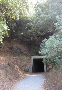
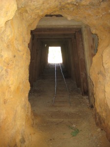
There are the remains of several shafts and tunnels around Mine Hill. The historic trail takes you to the San Cristobal Tunnel, the only tunnel you can enter in Quiksilver Park.
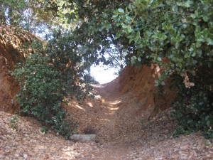
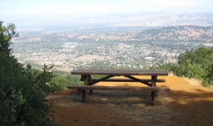
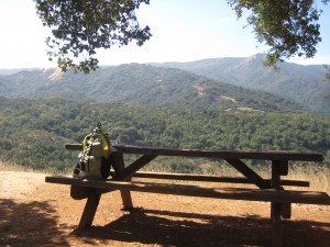
A short distance off the historic trail is the remains of the Catherine Tunnel, which now leads you to a picturesque lunch spot overlooking the Santa Clara Valley.
Another lunch option is at viewpoint post 8 on the trail, with spectacular views of the (not sure what it is called?) valley from Loma Prieta Peak, epicenter of the devastating 1989 earthquake, to Mount Umunhum, a former Air Force early warning radar base which the Mid-Peninsula Open Space District is working hard to open to recreational use.
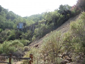 The trail next passes the April trestle. Unprocessed ore would travel be transported from the highest tunnels and shafts by rail car to the trestle where it would be dumped into wagons waiting below to continue down to the processing facilities at the base of the mountain.
The historic trail is about seven miles in length but covers only a tiny fraction of the Almaden Quiksilver Park. It is a beautiful, remote park within easy driving distance from Highway 85. Much of it is unshaded and can get very hot, so it is best hiked between October and April.
When Andrea is not hiking, she is a Senior Technical Writer at Phoenix Technical Publications. Phoenix Tech Pubs has provided complete technical writing and documentation services in the San Francisco Bay Area for over 25 years.